
Mapia CONNECT Overview
Mapia CONNECT, offered by Asesoria Informatica de Sistemas CAD, S.L.U. (AISCAD), is an application and plug-in solution integrated with Bentley and Mapia ecosystems that leverages over 30 years of CAD and GIS expertise to support digital transformation in infrastructure projects across multiple industries—including architecture, engineering, construction, energy, government, transportation, and water utilities—by enhancing geospatial production, optimizing design and asset management workflows, and providing tailored, outcome-driven solutions with flexible licensing models.
Close
What is it you are searching for ?
Search our site for products, services, training and support

Connect with providers of complementary solutions to drive successful infrastructure projects
Explore and engage with our global, innovative ecosystem to streamline workflows, and achieve greater efficiency.
Slide 1 of 1
Search Mapia CONNECT
Mapia CONNECT
Asesoria Informatica de Sistemas CAD, S.L.U.
Enquire Now
Solution Type:
Applications and Plug-ins
Platform Category:
- Open Applications and MicroStation
Lifecycle Phase:
- Build
- Design
- Operate and Maintain
Industry:
- Architecture, Engineering & Construction
- Energy Production
- Government
- Transportation
- Water Utilities
Web Page:
https://www.mapia-technologies.com/
Company Description
AISCAD brings over 30 years of expertise in CAD and GIS, delivering a powerful blend of technical excellence and consultative insight to drive digital transformation for engineering firms, construction companies, and public administrations. With deep proficiency in the Bentley and Mapia ecosystems, AISCAD enables advanced geospatial production while guiding clients in optimizing infrastructure design and asset management processes. Its extensive cross-sector experience—spanning engineering, architecture, construction, and urban planning—underpins a strong commercial approach focused on delivering tailored, outcome-driven solutions aligned with flexible licensing models. This integrated strategy allows AISCAD to create measurable value and build close, long-term client relationships, going well beyond traditional software reselling.
Enterprise Spatial Production — Smart GIS Workflows for Infrastructure Teams
Solution Description
Mapia Connect is a collaborative GIS production environment that standardises data workflows, enforces quality and governance, and helps teams prepare spatial datasets for design, planning, asset management and operational use ; serving water, transport, energy, and urban infrastructure stakeholders. Building on Mapia’s modular GIS architecture, it streamlines creation, update and publishing processes.
Benefits
Improve Data Quality at Scale
Structured production reduces errors across large geospatial datasets.
Support Multi-Team Collaboration
Standardised workflows unify GIS, planners, engineers and operators.
Work More Efficiently
No need to toggle between CAD and standalone GIS tools.
Save Time Accessing Data and Avoid Duplication
One hub reduces data hunting. Reuses trusted sources.
Strengthen Governance & Compliance
Controlled updates and auditing improve enterprise accountability.
Accelerate Project Delivery
Faster data prep supports design and construction workflows.
Reduce Coordination Errors
Spatial integrity checks enforce network logic.
Scale your needs
Upgrade your program based on required capabilities, from Lite to Standard, from Standard to Premium.
Features
Spatial & GIS functionalities
Adds rich GIS processing and spatial analysis to Bentley MicroStation and related CAD platforms, empowering infrastructure designers to perform geoprocessing, topology management, attribute analysis and spatial editing without leaving their CAD environment — accelerating decision-making and reducing the need for tool switching.
\* Spatial Analysis Tools Buffers, overlays, proximity and spatial queries inside CAD.
\* Topology & Network Validation Maintain data integrity for infrastructure networks.
\* Attribute Management Edit and manage data attributes from within CAD.
\* Multi-Format Support Import/export vector and database formats (SHP, GeoJSON, CSV, Geopackage, PostGIS. ORACLE…)
Third party data: consolidates spatial information from multiple sources (local, network, internet APIs) into one environment
\* Multi-Source Data Access Access local, network, internet or API feeds.
\* CAD & GIS Viewport Visualize mixed formats side-by-side.
\* Data Preview & Search Fast discovery without full load.
Main features:
\* Collaborative GIS Production Framework Supports team-based editing, workflows and versioning across spatial data projects.
\* Standardisation & Data Governance Enforces schemas, rules and classification to maintain consistent geodata quality.
*Role-Based Access & Workflow Control Allows data managers to control edit rights and publishing flows.
\* Publishing & Distribution Pushes verified spatial data into web portals, CAD/GIS clients, and asset systems.
Bentley Brands Associated with Solution
- MicroStation
- OpenCities
Additional Material
Mapia CONNECT
Application Data Sheet
Images

Video
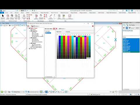
Mapia Connect tutorial | Data models
Mapia allows working through a data model or specification sheet, always managing: structure, topological rules, types of elements, attributes, element groups, views, resources, cells, styles... Once connected, the user can interact directly with entities and not with levels or individual elements.