
Mapia STREETS
Mapia STREETS, offered by Asesoria Informatica de Sistemas CAD, S.L.U. (AISCAD), is an application and plug-in solution integrated with Bentley and Mapia ecosystems that leverages over 30 years of CAD and GIS expertise to support digital transformation in infrastructure projects across multiple industries—including architecture, engineering, construction, energy, government, transportation, and water utilities—by providing advanced geospatial production, optimized design and asset management workflows, and flexible licensing tailored to deliver measurable value and long-term client partnerships.
Close
What is it you are searching for ?
Search our site for products, services, training and support

Connect with providers of complementary solutions to drive successful infrastructure projects
Explore and engage with our global, innovative ecosystem to streamline workflows, and achieve greater efficiency.
Slide 1 of 1
Search Mapia STREETS
Mapia STREETS
Asesoria Informatica de Sistemas CAD, S.L.U.
Enquire Now
Solution Type:
Applications and Plug-ins
Platform Category:
- Open Applications and MicroStation
Lifecycle Phase:
- Build
- Design
- Operate and Maintain
Industry:
- Architecture, Engineering & Construction
- Energy Production
- Government
- Transportation
- Water Utilities
Web Page:
https://www.mapia-technologies.com/
Company Description
AISCAD brings over 30 years of expertise in CAD and GIS, delivering a powerful blend of technical excellence and consultative insight to drive digital transformation for engineering firms, construction companies, and public administrations. With deep proficiency in the Bentley and Mapia ecosystems, AISCAD enables advanced geospatial production while guiding clients in optimizing infrastructure design and asset management processes. Its extensive cross-sector experience—spanning engineering, architecture, construction, and urban planning—underpins a strong commercial approach focused on delivering tailored, outcome-driven solutions aligned with flexible licensing models. This integrated strategy allows AISCAD to create measurable value and build close, long-term client relationships, going well beyond traditional software reselling.
Transform Street-Scale Mapping & Inspection with Mobile Mapping Insight
Solution Description
Mapia Streets lets infrastructure teams work with LiDAR and 360° panoramic data, providing asset extraction, annotation and spatial editing tools for street and corridor inventories feeding richer spatial context into Bentley design and digital twin workflows.
Benefits
Faster Field Data Capture
More efficient corridor surveys reduce field resource time.
Improve Inspection Quality
Rich imagery and point clouds support precise condition checks.
Optimize Road/Asset Data
Better base data for design and maintenance planning.
Reduce Rework & Risk
Clear spatial context minimizes errors in engineering workflows.
Improve Cross-Team Accessibility
Field crews, planners and executives see the same data.
Boost Decision Speed
Web access accelerates situational understanding.
Enhance Transparency
Controlled views support collaboration with regulators/partners.
Lower IT Burden
No heavy installs or desktop licensing required.
Scale your needs
Upgrade your program based on required capabilities, from Lite to Standard, from Standard to Premium.
Features
Publication and distribution
This has a web module for publication, this is a secure, browser-based GIS platform that lets planners, engineers and operations teams access, visualize and share project data without heavy local software. It supports multi-device access and brings spatial insight to executive, field and stakeholder workflows.
\* Web-First Mapping Interface Accessible via any modern browser with no desktop install.
\* Layer & Data Management Supports vector, raster, attribute and basemap layers.
\* User & Role Control Administrators manage who sees what, with secure login and permissions.
\* Open Standards Built on OGC services and GeoJSON for interoperability.
Main features:
\* Point Cloud & Imagery Integration Ingests LiDAR and panoramic captures for visualization.
\* Asset Extraction Tools Digitizes road signs, poles, curbs and infrastructure elements.
\* Smart Editing & Annotation Add metadata and adjust geometry with spatial accuracy.
\* Export to GIS/CAD Produces exportable layers ready for Bentley CAD and GIS ecosystems.
Bentley Brands Associated with Solution
- MicroStation
- OpenCities
Additional Material
Mapia STREETS Data Sheet
Images

Video
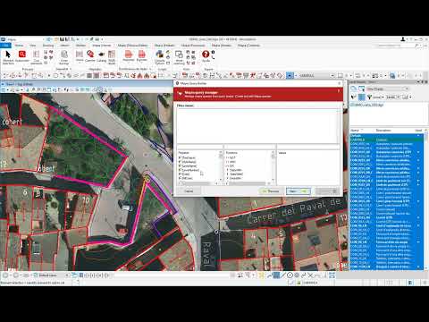
Mapia Connect tools | Home | Query Browser
Mapia CONNECT Tutorial
a6467108339449856.cdn.optimizely.com
a6467108339449856.cdn.optimizely.com is blocked
This page has been blocked by an extension
- Try disabling your extensions.
ERR_BLOCKED_BY_CLIENT
Reload
This page has been blocked by an extension