OpenRoads Designer
OpenRoads Designer is a comprehensive road design software starting at $7,226 USD that enables teams to create detailed 3D road models and BIM deliverables with advanced template-based tools, integrated 2D and 3D workflows, scalable data handling for large geospatial datasets, and includes a 12-month subscription with licenses and training/service credits.
Close
What is it you are searching for ?
Search our site for products, services, training and support
OpenRoads Designer
Starting at
$7,226.00 USD
Road design software
Purchase OpenRoads Designer Free trial
BENEFITS
3D Road Design and Modeling
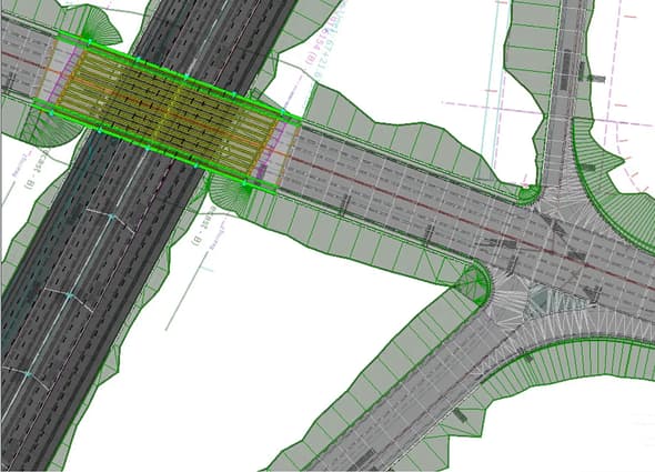
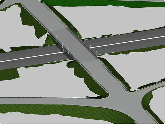
OpenRoads Designer helps teams design, model, and document road projects with 3D workflows and BIM deliverables.
-
Advanced road design and modeling
Model everything from pavement to terrain with advanced, template-based tools. Full BIM and point cloud integration ensures total design accuracy.
-
Integration of 2D and 3D workflows
Build one intelligent model with synced 2D sheets and 3D geometry. OpenRoads automatically generates and updates plans, profiles, and cross-sections from your design model.
-
Scalable data federation
OpenRoads handles large geospatial datasets, point clouds, and terrain models that crash less advanced CAD software.
PRICING OPTIONS
Exclusive pricing options
OpenRoads Designer
A comprehensive application for detailed design of road networks, including survey and drainage.
Starting at
$7,226.00USD
12-month Virtuoso subscription
Includes 1 license and 2 Keys for training or services Keys are credits that can be redeemed for expert services and tailored training. Keys do not represent number of licenses.
- Model-based design tools deliver accurate road and highway designs that reflect real-world conditions.
- Built-in drainage, geotechnical, and utility tools support full BIM workflows in a single environment.
- AI-powered label organization keeps construction plans clear, reducing errors and costly rework.
- Direct integration with the iTwin Platform publishes designs as data-rich iModels for collaborative review.
- ProjectWise connectivity enables secure file sharing and version control across project teams.
Add to cart
- Enterprise and other licensing options
Ask us about scalable licensing options and dedicated support.
Get in touch
Access Bentley software, training, and resources free for academic use.
Get started with Bentley Education
More details
Technical capabilities
Platform
- All MicroStation® functionality
- Production drafting
- Create parametric solids, surfaces, meshes, and feature models
- Item types for custom attribution
- Reporting and tables
- Easily integrate hundreds of geographic coordinate systems
- Printing and plotting
- Integrate CAD data in many formats: DGN, DWG, DXF, PDF/U3D, IFC, Rhino 3DM, STL, VRML World, and SketchUp SKP
- Integrated Bentley LumenRT visualization capabilities
- ProjectWise® integration
- Automate civil workflows using the Python API
- Open, review, and report on data from read-only files
Terrain modeling
- Import from 20+ common formats (graphics, point clouds, ascii, InRoads®, GEOPAK, MX, LiDAR, DEM, and LandXML)
- Import from Esri, USGS, and SRTM services
- Create complex and delta terrain models
- Edit terrain models
- Transform terrain models
- Label contours and spot points
- Display contours, triangles, spots, and flow arrows
Geotechnical
- Integrate OpenGround®
- Query gINT® project files
- Display borehole locations, profiles, and cross sections
- Annotate boreholes
Geometry
- Horizontal geometry (arc or chord)
- Horizontal geometry spirals: Clothoid, Bi-quadratic Parabola, Bloss, Sinusoid, Cosine, various Cubic Parabola, and more
- Vertical geometry (parabolic or circular)
- Horizontal and vertical best fit and regression
- Customizable geometry reports
- Import geometry from GEOPAK input files
Survey
- Read/write standard raw survey formats
- Reduce survey data
- Feature coding for custom survey
- Feature connectivity, display, and annotation
- Adjustments: least squares, compass, Crandall, and transit
- Produce dynamic graphical and tabular editing of survey field book data
- Conduct terrain modeling
- Export common data formats
Reality modeling
- Use raster images
- Attach point clouds
- Attach reality meshes
- Classify point cloud classification
- Use reality mesh edit, drape, and extract tools
- Develop scalable terrain models
Drainage and utilities
- 3D modelling of utilities, storm, and sanitary drainage steady-state (e.g. rational method) hydraulic design and analysis
- Culvert design and hydraulic analysis
- Unsteady-state hydraulic analysis
- Pond design and analysis
- Hydraulic analysis of low-impact developments
- Import GEOPAK and InRoads drainage data
Modeling
- Corridor modeling
- Superelevation/Cant
- Sweep envelope
- Site grading optimization
- Dynamic cross sections
- Earthworks – triangulated and end area volumes.
- Customizable earthwork reports
Deliverables
- Plan and profile sheet generation
- Cross section sheet generation
- Sheet and object annotation
- Reporting
- Synchronization with Bentley Infrastructure Cloud™
- Export to common formats: DWG, DXF, LandXML, and IFC
System requirements
Processor:
- Intel® or AMD® processor 2.5 GHz or greater
Operating System:
- Windows 11 (64-bit)/ Windows 11 (21H2) - Home, Pro, Enterprise, and Education
- Windows 10 (64-bit)/ Windows 10 (21H2) - Home, Pro, Enterprise, and Education
- Windows Server 2019
- Windows Server 2022*
- Bentley does not support its software running on Microsoft operating systems versions that Microsoft has "retired". For more information see Microsoft's application retirement policy and the Bentley Application Support Lifecycle, click here.
*LumenRT is not certified on Windows Server 2022.
Memory:
Minimum 25 GB free disk space (Minimum 42 GB disk space if additional companion applications/products included)
Video:
See the graphics card manufacturer for latest information on DirectX drivers. 1024 MB of video RAM or higher is recommended. If insufficient video RAM or no graphics card supported by DirectX can be found, OpenRoads Designer attempts to use software emulation. For optimal performance, graphics display color depth should be set to 24-bit or higher. When using a color depth setting of 16-bit, some inconsistencies will be noted.
Screen Resolution:
1920 x 1080 or higher
MSAccess 64-bit engine:
To connect to an Access database, you must download and install the Microsoft Access Database Engine 2016 Redistributable. Use the following link to download and install the MS Access Database Engine 2016 Redistributable. This is required for access to gINT projects and for the ability to import InRoads drainage files.
Licensing and subscriptions
Explore your subscription options and understand how access works before, during, and after purchase.
See more
RELATED PRODUCTS
You might also be interested in...
Enjoy OpenRoads Designer? Expand your toolbox and your capabilities with these related products.
OpenRoads ConceptStation
Starting at
$4,656.00USD
Road and bridge concept design software
OpenRoads SignCAD
Contact Us
Transportation sign design software with built-in compliance
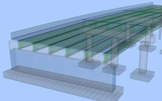
OpenBridge Designer
Starting at
$10,028.00USD
Integrated bridge design, analysis, and modeling software
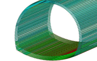
OpenTunnel Designer
Starting at
$7,539.00USD
Tunnel design software
USER STORIES
Real stories. Real results.
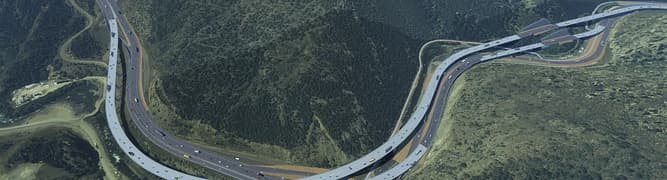
CDOT alleviates severe bottlenecks along interstate\ (opens in new tab)
Using OpenRoads Designer, CDOT saved over $7M and 50,000 work hours on the I-70 Floyd Hill project through project digitalization.
Bridge survey program saves Kentucky USD 300 million\ (opens in new tab)
Qk4 used Bentley's OpenRoads Designer Survey to create intelligent 3D models, combining traditional survey data with drone imagery and 3D laser scanning.

Larsen & Toubro helps develop Dholera as India’s first smart greenfield city\ (opens in new tab)
Larsen & Toubro improved productivity by 25%, using OpenRoads' subsurface utility design analysis workflow. Automating previous manual modeling processes, they reduced work hours from 4,000 to 3,000.
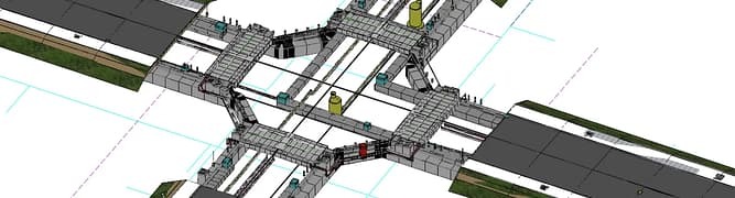
Beca uses 3D design and a collaborative environment on Takitimu North Link south of Auckland, N.Z.\ (opens in new tab)
Streamlined digital workflows allowed teams to consider more options, which reduced tender costs and improved design efficiencies by 20%.

Set 1 of 1
FAQS
Find answers
What is OpenRoads Designer used for?
OpenRoads Designer is the complete, all-in-one software that equips engineers and designers in DOTs and engineering firms to deliver accurate, model-based road and highway designs. The software streamlines project workflows by simplifying updates from field survey data and enhancing collaboration with stakeholders. Its new AI-powered label organization helps eliminate errors and costly rework by ensuring clear, uncluttered plans from the start.
Does OpenRoads support BIM workflows?
With tools for parametric modeling, drainage, geotechnical analysis, and utility relocation, OpenRoads Designer fully supports BIM workflows and prepares designs for the digital twin lifecycle. It integrates directly with the iTwin Platform, letting you publish designs as data-rich iModels and visualize them in iTwin Experience for collaborative review. The result is smart, connected designs that serve as the foundation for a project's entire lifecycle of operation and maintenance. Its open ecosystem also supports interoperability across CAD and GIS platforms, boosting efficiency from start to finish.
How does OpenRoads handle large data files?
OpenRoads Designer is built to handle the large, complex datasets common in road and highway projects. It uses a managed workspace structure that organizes project data efficiently, keeping file sizes manageable without sacrificing detail. Reference attachments allow teams to work with large survey, terrain, and design files without loading everything into a single file, reducing lag and improving performance. Cloud-connected workflows through ProjectWise further support large file management by enabling teams to access, share, and sync project data securely from a central location.
Is OpenRoads suitable for DOT and municipal road projects?
OpenRoads Designer is purpose-built for the demands of DOT and municipal road projects. It supports agency-specific standards and workflows out of the box, making it easier for teams to meet local and federal compliance requirements without extensive customization. From rural highway expansions to urban intersection redesigns, the software scales to projects of any size and complexity. Built-in tools for survey, geometry, corridor modeling, drainage design, plan production, and more help DOTs and municipalities move from preliminary engineering to final deliverables efficiently and accurately.
How does OpenRoads Designer integrate with other Bentley tools?
OpenRoads Designer integrates seamlessly across the Bentley product ecosystem, creating a connected workflow from design through construction and operations. It works directly with OpenBridge Modeler for bridge design, OpenUtilities for utility coordination, and SYNCHRO for construction scheduling. Project data can be published to the iTwin Platform as data-rich iModels, enabling collaborative review in iTwin Experience. Integration with ProjectWise ensures teams can manage, share, and version-control project files securely throughout the project lifecycle, reducing data silos and keeping all disciplines aligned.
See more
Contact us
Loading form...
Message received.
Thanks for getting in touch.
A member of our sales team will contact you to answer your questions and help you find the right option for your team.
RESOURCES
Your hub for all things OpenRoads Designer
Build your OpenRoads Designer expertise with free, on-demand webinars, community forums, technical documentation, and more.