
Zoneomics
Zoneomics provides standardized, GIS-ready zoning and land-use intelligence by converting complex municipal zoning codes into authoritative datasets that integrate with planning, infrastructure modeling, and digital twin workflows to help architecture, engineering, and construction teams reduce risk, improve site feasibility, and accelerate project planning across various industries.
Close
What is it you are searching for ?
Search our site for products, services, training and support

Connect with providers of complementary solutions to drive successful infrastructure projects
Explore and engage with our global, innovative ecosystem to streamline workflows, and achieve greater efficiency.
Slide 1 of 1
Search Zoneomics
Zoneomics
Zoneomics Incorporated
Enquire Now
Solution Type:
Data and Data Capture
Platform Category:
- Cesium
Lifecycle Phase:
- Build
- Design
Industry:
- Architecture, Engineering & Construction
- Campuses
- Commercial Facilities
- Electric Utilities
- Energy Production
- Government
- Manufacturing
- Transportation
Web Page:
Standardized Zoning Intelligence for Planning, Infrastructure, and Digital Twin Workflows
Solution Description
Zoneomics delivers authoritative zoning and land-use intelligence that enables infrastructure, planning, and engineering teams to better understand development constraints and regulatory conditions at scale.
The platform converts complex municipal zoning codes into standardized, GIS-ready datasets that integrate seamlessly with planning, infrastructure modeling, and digital twin workflows. By providing consistent, up-to-date zoning intelligence, Zoneomics helps organizations reduce risk, improve site feasibility analysis, and accelerate project planning and decision-making.
Class
Dataset
Resource Type
- Geospatial: Vector
Benefits
Standardized Zoning Intelligence for Planning, Infrastructure, and Digital Twin Workflows
Business Benefits
Faster Planning and Feasibility Analysis Reduce time spent interpreting zoning regulations and accelerate early-stage planning and evaluation.
Improved Infrastructure Decision-Making Enable more informed infrastructure design and investment decisions with accurate land-use intelligence.
Reduced Risk & Greater Confidence Minimize uncertainty by relying on standardized, verified zoning data instead of manual research.
Operational Efficiency Eliminate repetitive zoning research and improve collaboration across planning, engineering, and development teams.
Supports Digital Twin & Smart City Initiatives Provides foundational land-use intelligence that enhances digital twins, scenario modeling, and long-term infrastructure planning.
Standardized Zoning Intelligence for Planning, Infrastructure, and Digital Twin Workflows
Technical Benefits
Standardized Zoning & Land-Use Data Transforms fragmented municipal zoning codes into normalized, machine-readable datasets suitable for enterprise use.
Parcel-Level Spatial Accuracy Provides zoning attributes at the parcel level, enabling precise analysis for infrastructure planning, site feasibility, and land-use modeling.
GIS Designed for integration with GIS platforms and digital twin environments to support planning, simulation, and scenario analysis.
Scalable Geographic Coverage Supports regional and national-scale datasets, enabling consistent analysis across jurisdictions.
Continuously Maintained Data Zoning datasets are regularly updated to reflect code amendments and regulatory changes.
Bentley Brands Associated with Solution
- Cesium
Creation Date
2020-01-01T00:00:00
Geographical Scale
US, Canada & Australia
Resolution
Data is in vector format therefore resolution not applicable.
Coordinate Reference System
WGS 84, EPSG:4326
Data Format
GeoJson, Shapefile, GeoDB, REST API or bulk data
Data Source
Government records
Update Frequency
Daily
Integration Options
- Cloud Storage (AWS/Azure)
- GIS Integration
- REST API
Type of Access
One Time Fee
Data Size & Storage
Over 100 GB for complete data.
Version
1.0
Allowed Use
Licensed dataset/
Security and Compliance
- Other (Specify)
Other Security and Compliance Standards
While we maintain strict security standards for our data, we currently do not comply with any of the recognized security standard.
Images

Zoneomics provides nationwide zoning and land-use intelligence, delivering standardized, parcel-level data on permitted uses, development standards, and regulatory constraints. Available via API, SaaS, and bulk delivery, the platform enables planners, engineers, and digital twin environments to quickly assess what can be built and where.
Video

Zoneomics March 2026 Product Release
Join Zoneomics CEO Matthew Player and CTO Asim Mushtaq as they walk through everything we shipped in March 2026, from powerful new features to meaningful platform improvements designed to make zoning intelligence faster, smarter, and more actionable.
In this release recap, you’ll get an inside look at how Zoneomics is continuing to evolve as the zoning intelligence layer for modern real estate decision-making.
In this video, you'll find a walkthrough of the update from March 2026, live product snippets show the new features in action, and insights from leadership on what these updates mean for users.
Why these updates matter: Zoning data is one of the biggest bottlenecks in real estate. These updates are designed to remove friction, reduce research time, and help you move faster with confidence.
🌐 Learn more about Zoneomics: https://www.zoneomics.com
👉 Get in touch with our team: https://www.zoneomics.com/contact
#Zoneomics #zoningintelligence #Proptech #RealEstateTechnology #ZoningData #CRE #AIinRealEstate #SiteSelection #LandUse #ProductUpdate
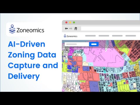
AI-Driven Zoning Data Capture and Delivery
Zoneomics is transforming zoning research, workflows, and due diligence by addressing critical challenges in accessing and digitizing fragmented data at scale. This video highlights how Zoneomics' AI-driven technology and innovative delivery channels provide unparalleled real estate intelligence tools, empowering users across the industry.

How to use the Zoneomics Web App Dashboard
In this quick demo, learn how to navigate and use the Dashboard on the Zoneomics app.
We’ll walk you through how to manage your saved searches, track usage activity, view recent purchases, and stay organized—all from one central hub.
Perfect for staying on top of zoning insights and streamlining your workflow.
📊 Start exploring at www.zoneomics.com 📌 Follow us for more tips and feature demos!
a6467108339449856.cdn.optimizely.com
a6467108339449856.cdn.optimizely.com is blocked
This page has been blocked by an extension
- Try disabling your extensions.
ERR_BLOCKED_BY_CLIENT
Reload
This page has been blocked by an extension